SHOCKER: DUIs Predominantly Occur Around Bars, Police Stations
— By Kevin Montgomery (@kevinmonty) |
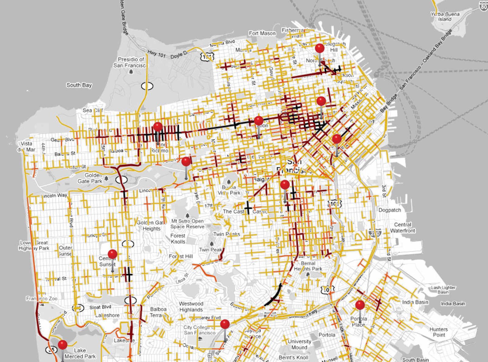
The darker the line, the more DUIs. Pins represent police stations.
Data cartologist Doug McClure recently published a bunch of maps of San Francisco DUI arrests over the past two years. No big surprises there: most of the DUIs occur around bars (16th and Mission, Castro and 18th, Columbus, Divis in the Lower Haight, and most of the TL/Nob Hill) and major thoroughfares (Geary, Broadway, Great Highway, San Jose Ave.), while industrial areas such as Potrero Hill are relatively DUI-free. However, comparing the DUI map to Eric Fischer's map of cab locations from 8pm-midnight reveal an odd enforcement pattern:
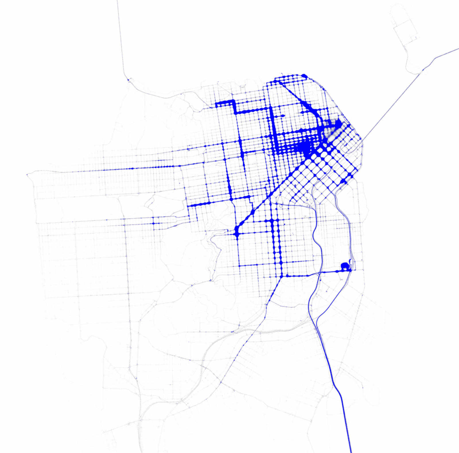
In theory, these two maps would match up pretty well; as cabs hover around the city's bars and nightlife and chauffeur people home, the density of cabs and DUIs should be fairly similar. For the most part they do, but overlaying the two directly exposes a few key differences:
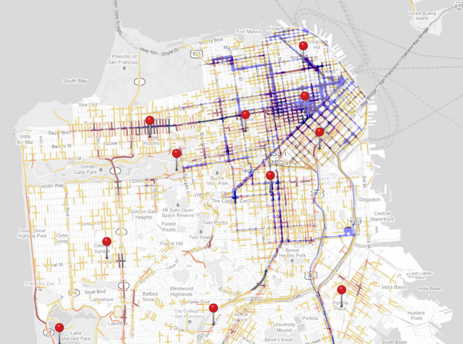
The popular cab route along Polk, Broadway, and in the Marina has very few DUIs. In the Mission, there are far more DUIs around 16th than around 24th, despite the cab volume being virtually the same. 24th and Castro in Noe are practically DUI free. And there's an explosion of DUIs in along Geary approaching Richmond Station, despite cab traffic falling off.
In a few of these locations, the high concentration of DUI arrests correlate with a nearby police station (represented by a red pin):
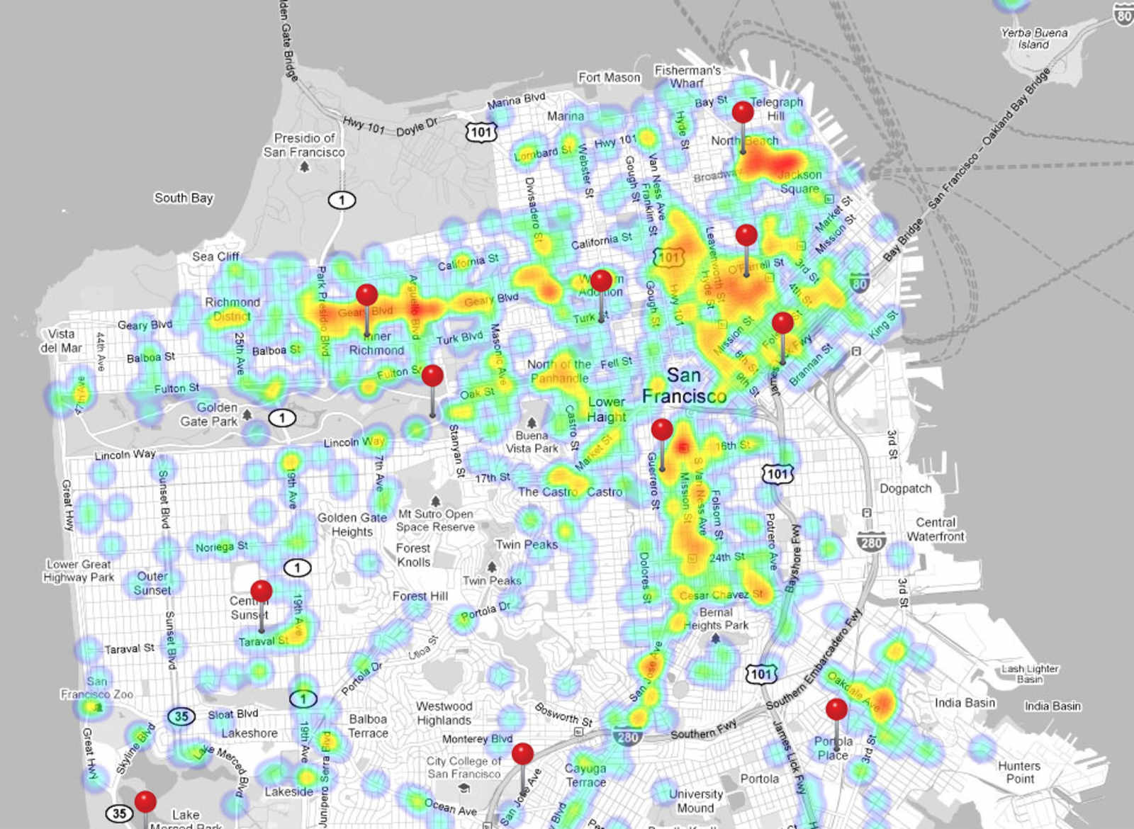
Does this data mean that SFPD does a poor job of enforcing drunk driving laws outside the immediate vicinity of their stations? Probably not; there's going to be more cruisers returning to and leaving from stations than cars patrolling 10 blocks away, so the likelihood of the police nabbing a drunk driver is much higher near a station. That said, if you're biking home late at night, you're probably safest from drunk drivers if you're riding near police stations than, say, riding down 17th on the way home from Retox Lounge.
