— By Kevin Montgomery (@kevinmonty) |
Matty Matt stumbled upon this by Camp and Alboin and I had no idea this map existed. Such a side-street amateur. He adds:
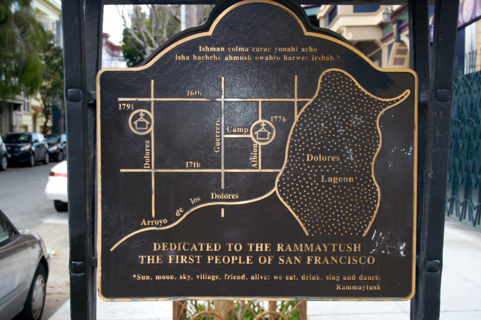
“Dolores Lagoon” or “Lago de los Dolores”? They are used interchangably. Also of note: Rammaytush on one side, Ohlone graffiti on the other.
(link)
Comments (4)
Building on top of a former lagoon may have unintended consequences.
The lagoon kind of looks like a lumpy guy taking a westward wizz while wistfully tossing his other arm backward. Anyway, I’m living on the northern end of the lake for sure.
Dreaming of fishes.
I believe this map is well-intentioned but a little misleading. Arroyo Dolores, as far as we know, was more closely aligned with 18th Street. (If you follow 18th up to Market, there’s a brown building with decks on the north side of the street that allegedly has to pump water out of its basement 24 hours a day.)
Also, that eastern “arm” should be a bit further south, and was really more of a tentacle: it’s Mission Creek, which spread out into a wetland around Folsom and continued on down to the bay. The modern-day remnants of its path are Treat Ave and Division St. (Actually, they’re remnants of the railroad; but the railroad is a remnant of the creek.)
Anyway! Did you see the piece I did for Streetsblog last week about creeks in Berkeley? I’m doing one this week about creeks in SF. Should be appearing Tuesday or Wednesday.
Also, keep your eyes peeled for WATERSHEDS!!! A new musical by Matt Baume.
Matt, that creeks thing was awesome, keep it up.